Kluane National Park and Reserve
As you drive towards Haines Junction, the distant breathtaking mountain vista of the Kluane National Park and Reserve greets you.
The 22 000 square kilometre Kluane National Park and Reserve is a UNESCO World Heritage Site. It is home to the highest peak in Canada, Mount Logan, the St. Elias mountain range, and the largest non-polar ice fields on the planet, in addition to abundant wildlife, flora, and fauna. There are numerous trails in the park ranging from half-day to multi-day trips in the backcountry. Hiking in this wilderness paradise was at the top of our activities list.
Our gateway to Kluane started in Haines Junction. When you meet a retired Parks Canada warden of 30 years, and he repeatedly tells you to be “Bear Aware,” you take him seriously, that’s what you do. The warden highly recommended we watch an informative 30-minute video on bear safety from the visitor centre.
We learned a lot and depending on a bear’s body language, offensive or defensive, it comes down to fight for your life or play dead. Either way, not scenarios we cared to engage in. Yukon is “Bear Country” and being prepared for the possibility of a bear suddenly appearing en route is very real. For our safety and piece of mind, we had bear spray readily available on our belts as we travelled in the northern wilderness.
Bears aside, here are two trails, serene and peaceful with stunning views to boot that we highly recommend.
King’s Throne Trail – A gem of a trail in the Yukon wilderness.
Location: 27 km (17 miles) south of Haines Junction on the Haines Road.
Distance: 10 km (6 miles) return to the plateau, “seat” of the throne, the common turn around point, or 15 km (10 miles) to the challenging summit.
Elevation gain: 548 meters (1800 ft) to the plateau.
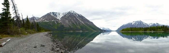
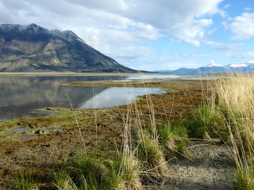
Postcard perfect scenery across the crystal water at Kathleen Lake.
The King’s Throne trail won’t disappoint. The trailhead starts from the campground at Kathleen Lake. We knew where to go, from a prior visit on our way to Haines, Alaska.
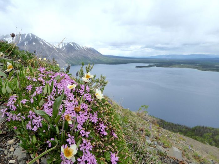
The first 20 to 30 minutes is easy walking along a well-cleared old miners road before entering the Alpine forest. The trail gets progressively steeper as you gain elevation. Above the tree line, the path is clear to follow through the loose rocks. And while you hike, stopping to enjoy the stunning views and the varied vegetation of mosses, lichens, grasses, and flowering plants, you’ll effortlessly reach the plateau.

Tundra plants: a dwarf shrub, the female Salix arctica.
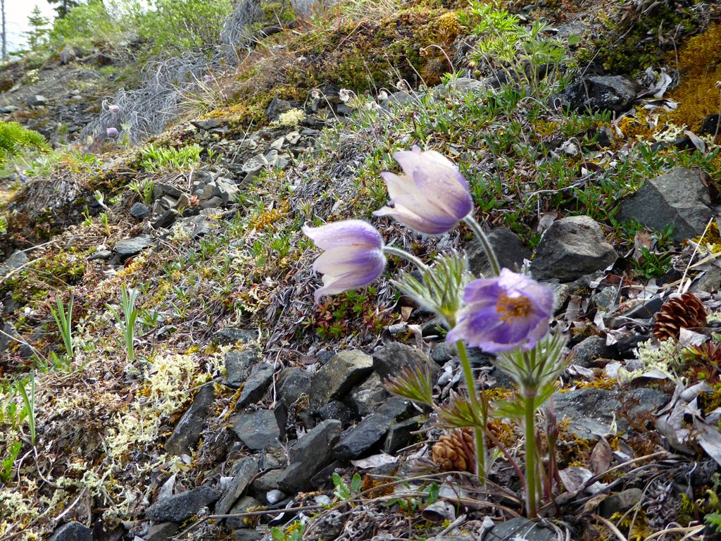
Blooming Pulsatilla or Northern Crocus (Anemone patens)
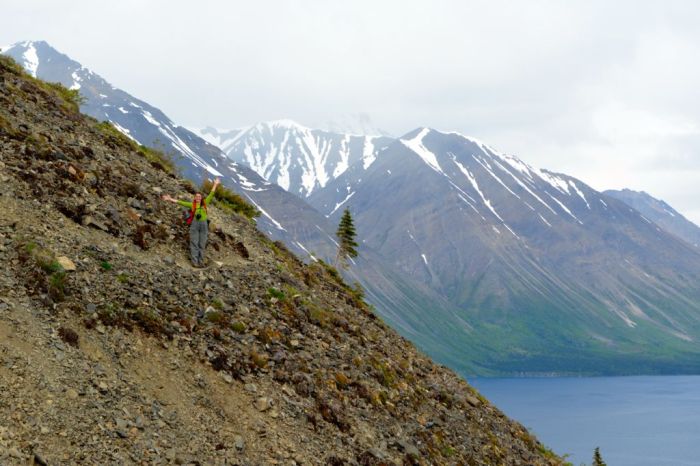
Maxine, navigating a steeper section of the trail. Here, a careful footing is needed on the loose scree and tight switchbacks.
Looking up towards our destination.
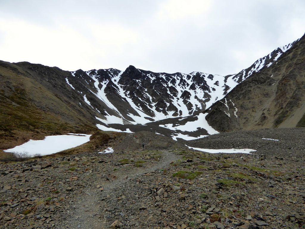
Looking up at the King’s seat.
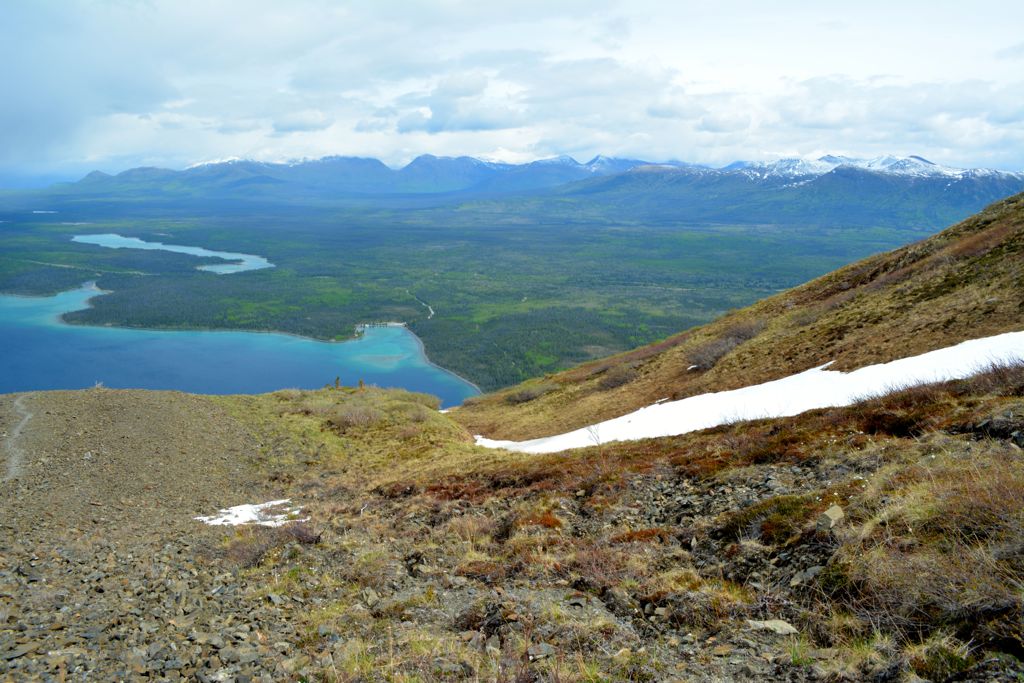
View of the surrounding valley and Kathleen Lake from the King’s chair.
The King’s “seat” was our destination. From this point, it was tempting to continue to the top; however, dark menacing skies from the north discouraged us. We turned down, navigated the steep scree slope at a quick pace to beat the rain. The shower caught up along the road. At the RV we dried up, snacked, and continued our drive north. Luckily, the wet weather didn’t last, and the late May daylight allowed enough time for one more adventure.
Sheep Creek Trail – Favoured for Dall Sheep sightings.
Location: 74 km (45.7 miles) one-hour drive North of Haines Junction on the Alaska Highway to Kluane Lake
Distance: 10 km (6 miles) return
Elevation gain: 430 meters ( 1400 feet)
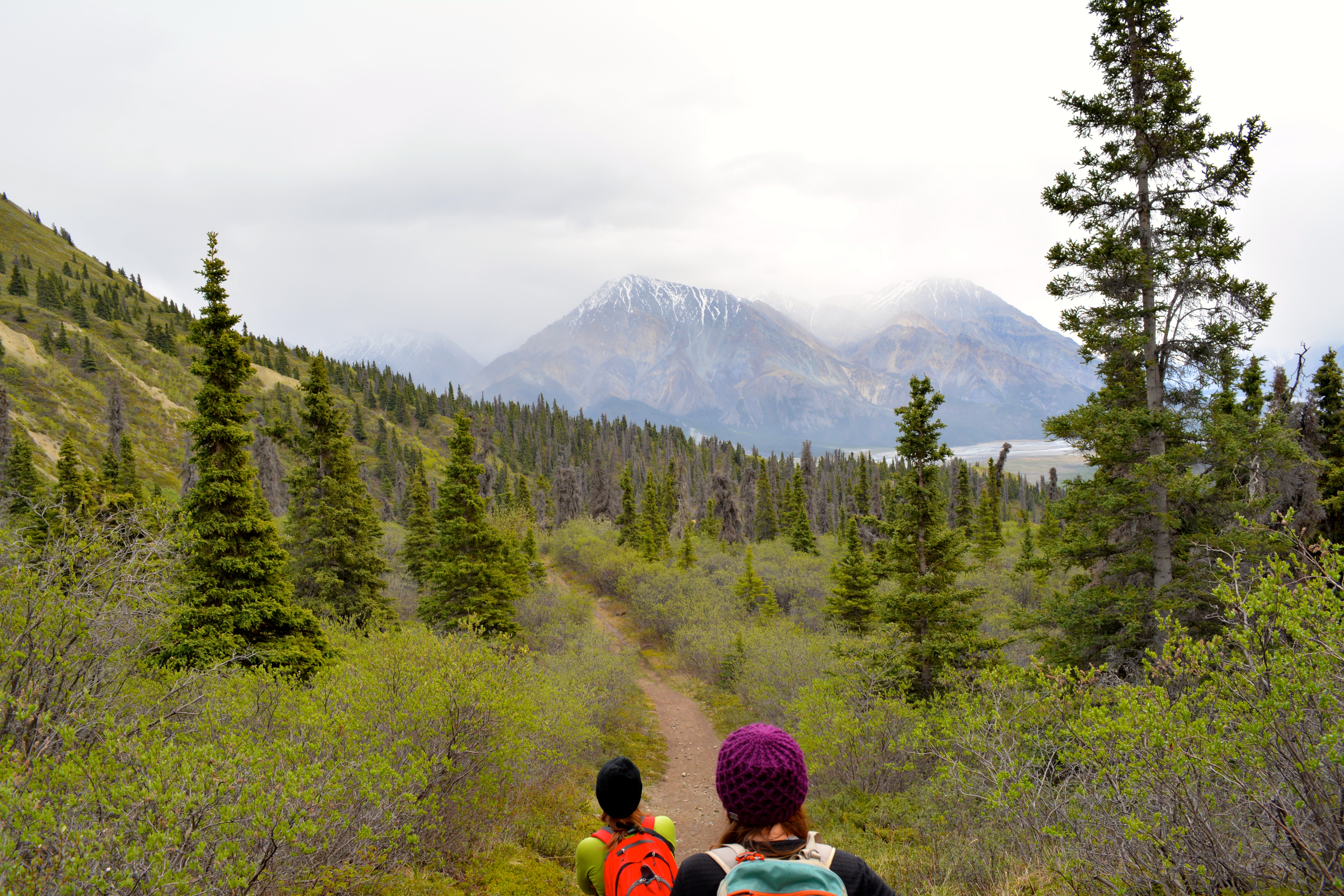
From the Tachäl Dhäl visitor centre, take the gravel Sheep Creek road for about 2.5 km until you reach the parking lot. From here, the trail climbs at a moderate grade through shrubs and Alpine forest–prime bear habitat.
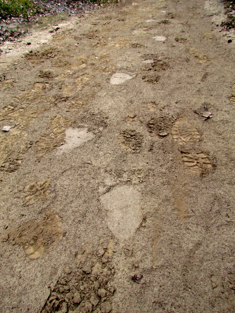
Sure enough, not far along the trail, we spotted paw tracks in the sandy soil. A few days old we guesstimated, still, as a precaution, we made sure to make our presence known. If Mr. or Mrs Bear was around, between Maxine’s singing and Ginette’s ongoing shouting conversation with visualised bear, they heard us.
“Hey Bear, we’re coming over the hill…Hey Bear, just passing through, we won’t stay long. Hey Bear, we’ll be on our way now, admiring your surroundings. Thanks for having us Bear!”
We can tell you that ruckus works because, well, we’re here to mention it.
The view, heading back down the trail.
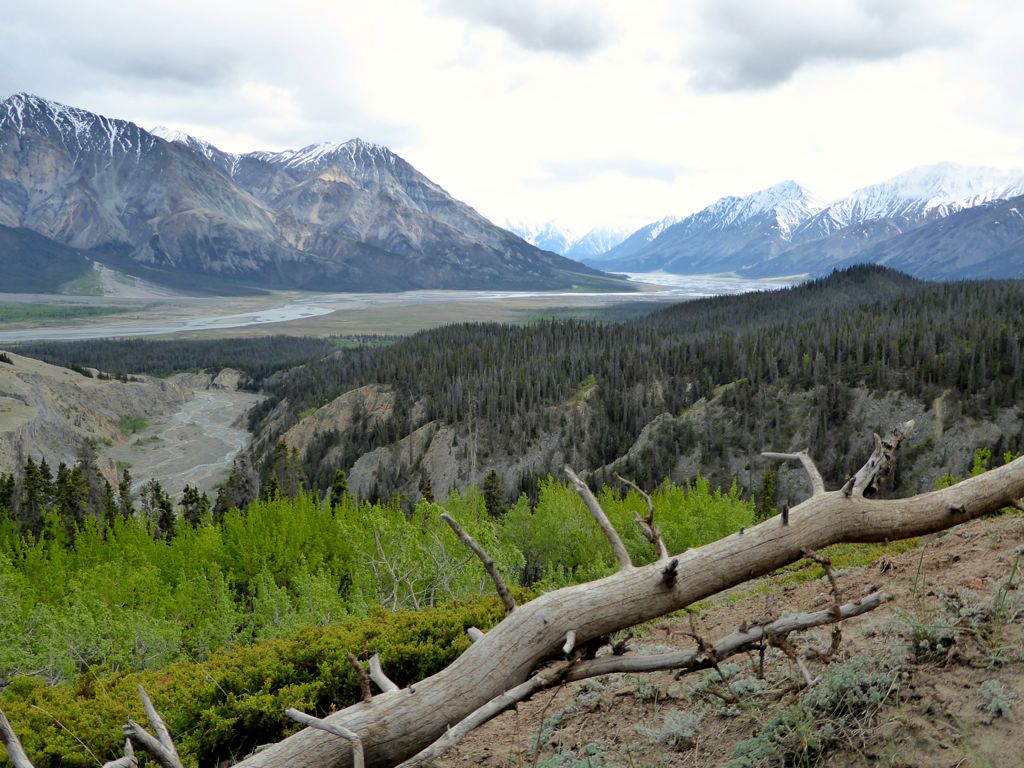
Overlook of the Slim’s River Valley and Kaskawulsh Glacier in the distance.
As the trail name implies, you can usually view Dall Sheep on the mountain sides. We did see a herd on a distant slope, but they were too far away, even with our zoom lens for clear pictures.
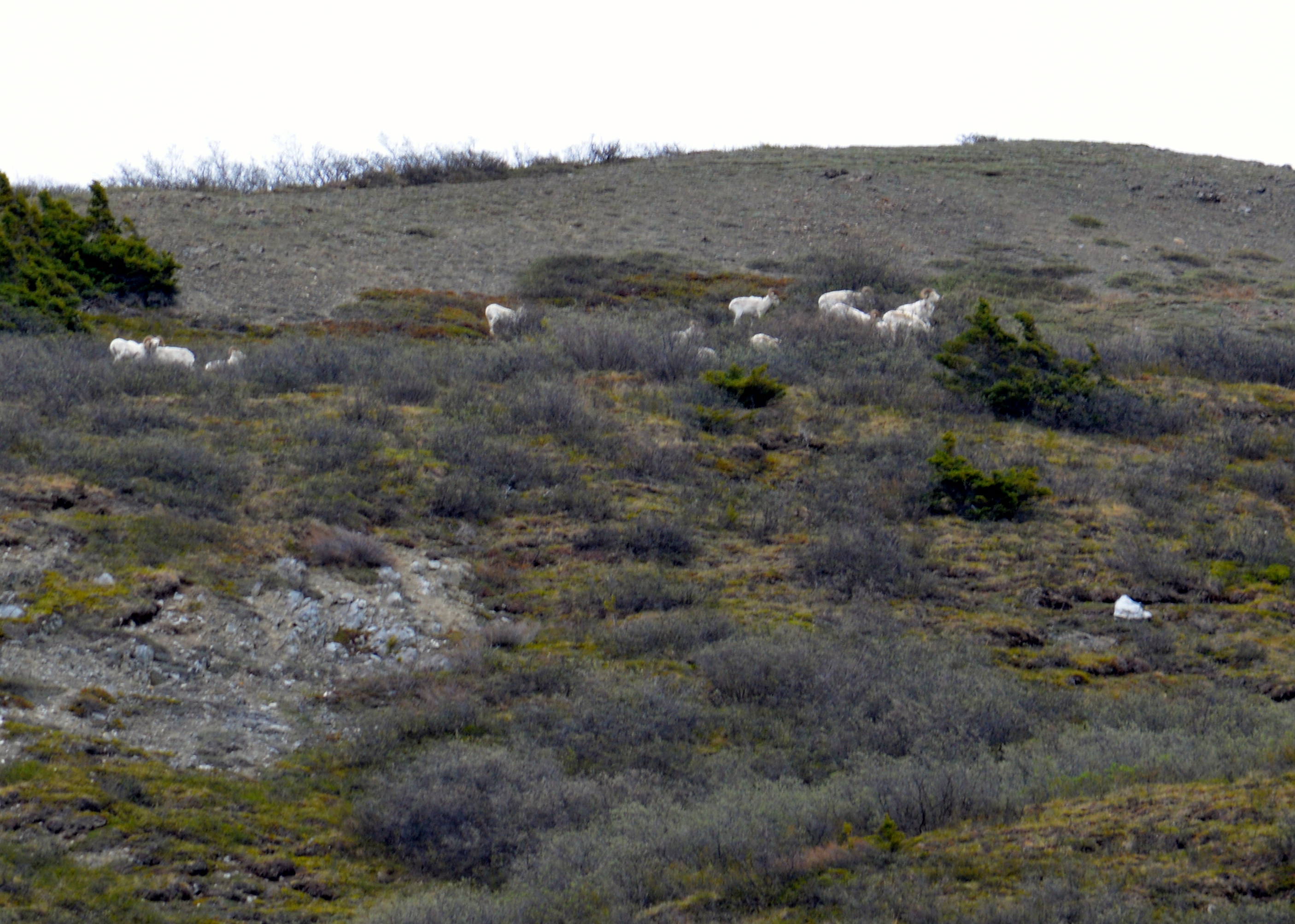
Dall Sheep, seen grazing on the south side of the mountains.
By the time we prepared to turn around, shifting winds had brought patches of blue in the sky. We knew nicer views were coming so we wandered back slowly. After several minutes, the skies opened up.
4 km marker on the trail with hoodoos in the distance.
On both hikes, it is possible to continue up the ridge along an unmarked path, but we decided to turn around. We’d had a full day. Next, time to relax fireside at the campground.
Congdon Creek – A Yukon government campground on Kluane Lake
Signage at the entrance to the campground reads, “No Tenting Permitted”, yet another reminder that we are in “Bear Country.”
From mid-May until September, Grizzlies like to frequent the area when the ripe Canada buffaloberry (Shepherdia Canadensis) are plentiful.
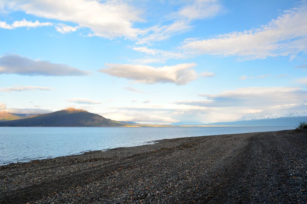
View of Kluane Lake from our Congdon campsite.
Early the next morning, we did a short half-hour walk, then took some departing shots from the gravel beach surrounding Kluane Lake before heading back to Whitehorse.
Kluane Lake from shore.
Parting shot of paw prints on the beach.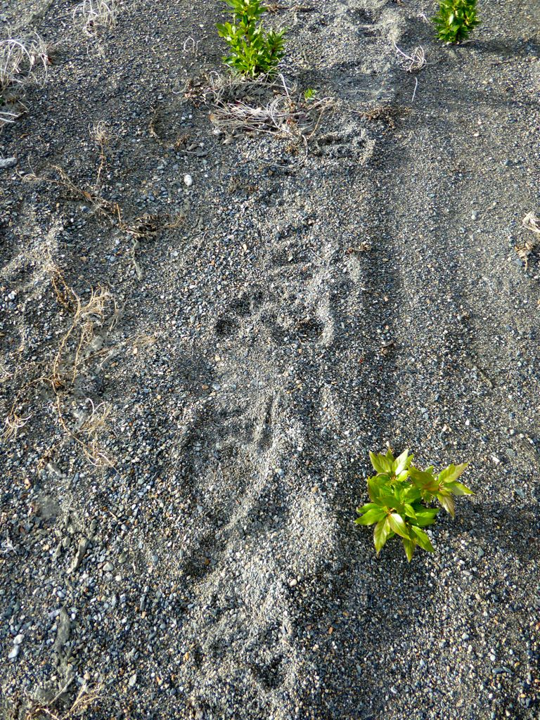 Have you had any bear encounters in the Kluane Wilderness?
Happy trails!


