Let’s go hiking in the Green Mountain State. “Vermont, naturally!”
We’ll take a ferry across Lake Champlain from Plattsburgh, New York to Grand Isle, Vermont, but first, let’s enjoy some time exploring the beach on the way.
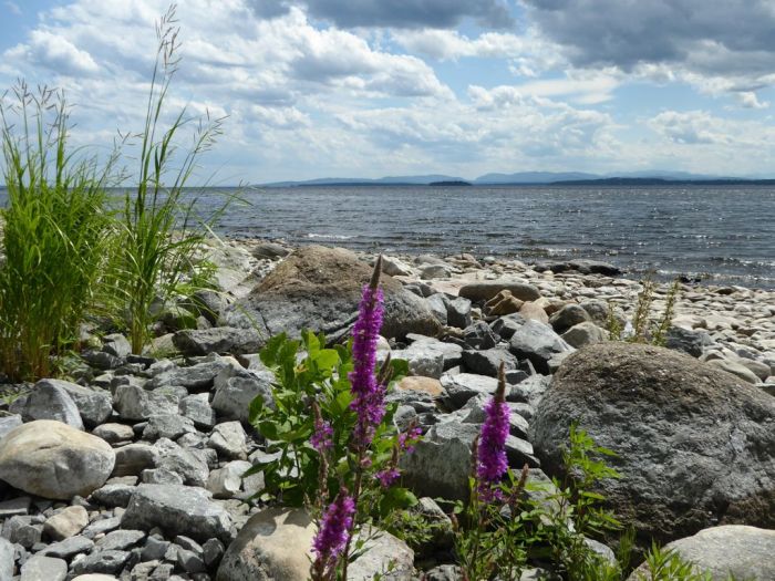
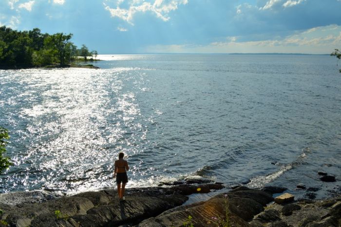
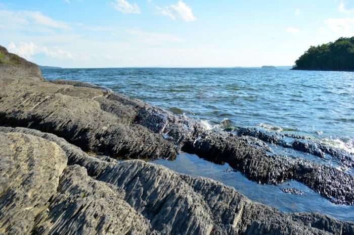
The rocky shore of Cumberland Bay. Lake Champlain, New York
Arriving on a Friday evening during the high season without a reservation is never a good idea. “Do you have any campsite available for tonight?”
“Uhm, let’s see?”
(Ginette glares at Gord)
“Yes, we have one left.”
Sight unseen — “Great, we’ll take it!” we both replied. (Ginette smiles at Gord)
Had we done some prior research, we might not have driven the 30 minutes out-of-the-way to the Underhill State Park knowing how small it is. Unlike most campgrounds we’ve experienced, with hundreds of RV and campsites, in comparison Underhill is quite tiny with 11 Lean-tos and 7 campsites. We lucked out.
The park may be small, but Underhill is a busy spot, with a steady flow of day hikers coming and going from the campgrounds parking lot to the many trailheads to Mount Mansfield.

We settled in and had a quick dinner before hiking the Sunset Ridge Trail to Cantilever Rock for sunset.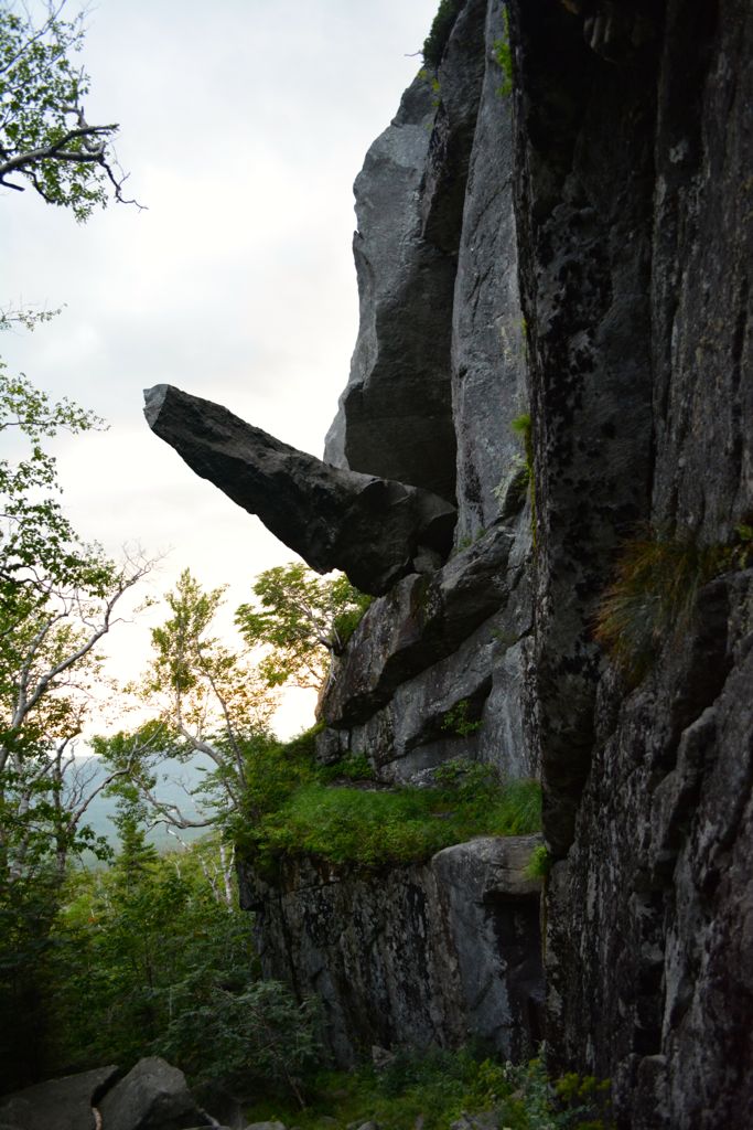
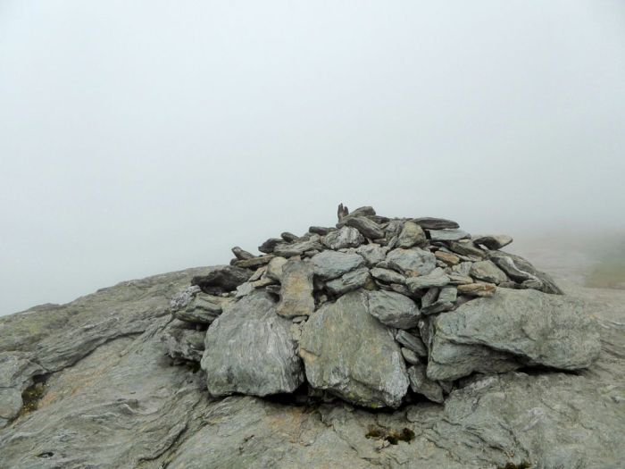
Mount Mansfield, Vermont’s highest peak is said to resemble a human profile, hence the name of its features – the Chin 4 393 ft (1 339 m) the highest point, Adam’s apple, the Nose, and the Forehead.
Halfway House Trail: elevation gain, 2 550 ft (774 m)
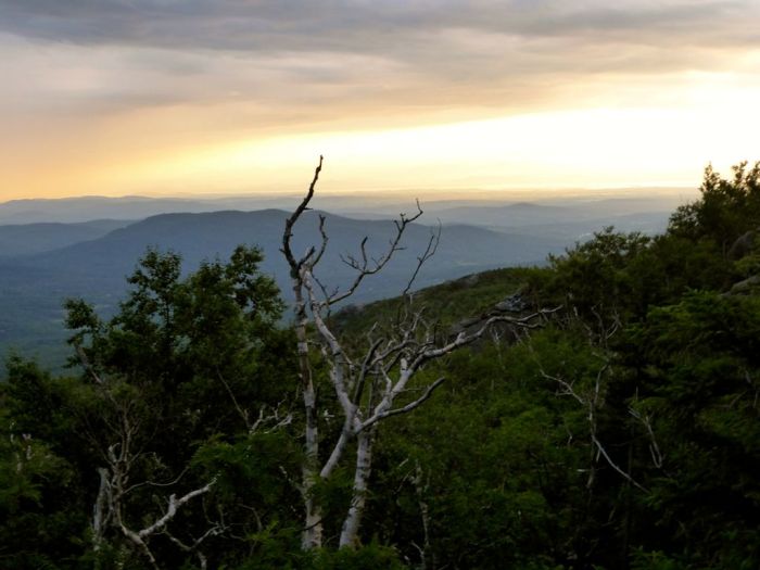
We don’t particularly like hiking in the July heat, so we elected to start early to get the most of the morning’s cool air. Our day started along the CCC road for the first mile. The plan was to make a loop, reach the summit quickly via the Halfway House Trail, and take the Sunset Ridge Trail back.
The way up involved some handwork and rock scrambling, just what we enjoy. Near the top, the trail intersects with the Long Trail of Vermont which starts at the Massachusetts border winding its way across 272 miles to the Canadian, Quebec border.
Mt. Mansfield is a highly visited peak, like neighbouring Whiteface Mountain in New York you can drive the auto toll road to the Summit station and continue to the peak by foot.
We checked out the Summit station, and from here we walked the spine from the Nose to the Chin.
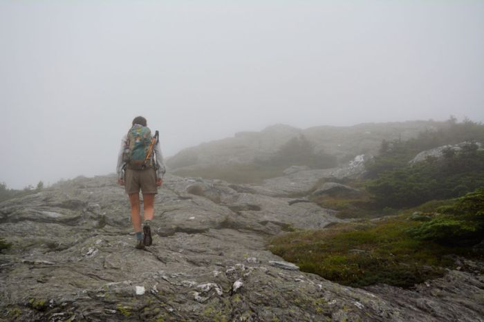
Outstanding views — not today!
Despite the lack of vista along the exposed bedrock ridge, the dampened colours; variegated rocky greys, mossy greens and russets of the Arctic Tundra was beautifully striking.
After the summit, we changed plans and decided to return along the shorter and steeper Laura Cowles Trail. We didn’t notice it so much on the way up, but navigating back down, we found the mica schist rock, common to the Green Mountains, quite slippery.
Nearing the bottom, we crossed many hikers heading up as we descended in the misty rain. “Why would anyone go up in this weather?” we wondered. Later, as we signed out from the trail register, the sun came out — we had our answer.
∼ ∼ ∼
Surely, arriving on a Saturday night without a reservation is much better.
“Sorry, we’re full.” (‘G’ gets a testy look from ‘G’)
Map and phone number in hand, we left in search of accommodation in the nearby town of Duxbury. We drove back and forth between Waterbury and Duxbury along the Winooski River looking for the recommended campground. Waterbury shuffle, Duxbury tango!
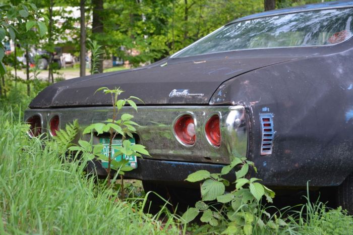
Eventually, we found a Hillbilly Heaven campground.
Gordon approved the camping site when he spotted this ’71 Chevelle’ parked nearby. “I had one just like that, my first car.”
While Ginette set up the tent in the common field, Gordon rummaged behind a shed and found a rusted tire rim, perfect for an improvised campfire ring. Perfect for roasted marshmallows, but dinner was back in Waterbury!
Camels Hump, Vermont’s iconic mountain peak. 4 083 ft (1 244.5 m)
Monroe Trail: elevation gain, 2 645 ft (806 m)
It’s pretty grey above us but we’re hopeful as we start the day along the Monroe Trail. We’re not sure if it was the gradual grade increase or that we’re in better shape, but it never feels difficult. We trek on to the summit.
Other than this small window when we first arrived at the peak, the clouds rolled in.

These two seemed to enjoy the view without electronics in hand.
At the junction of the Monroe and the Long Trail just below the summit we met a young couple who had climbed from the trailhead near the Winooski River, a good six-mile hike over 3 700 ft. of elevation gain. They were excited to be near the top but not looking forward to reversing their path and trekking out the way they came in.
Gord chimed in, “Hey you can catch a ride with us, and take the short way out after we reach the summit.”
So we teamed up and scampered down the way we came in. Back at the car, Matt and Gord hopped on our bikes and flew down the Camels Hump Rd. (no pedalling required) and continued along the Winooski River to the trailhead where they were parked. Hikers look after their fellow hikers.
∼ ∼ ∼
“Getting a camping spot on a Sunday night is never a problem Ginette!”
At Smugglers Notch State Park; “Yes, we have one spot left.” (G gives G a smirk)
Another small Vermont campground with a unique personality. Here the tenting sites are walk-ins, secluded and quiet.
We woke up to more cloudy weather, so decided to return home at a leisurely pace through the Vermont countryside, stopping to snap photos along the way.


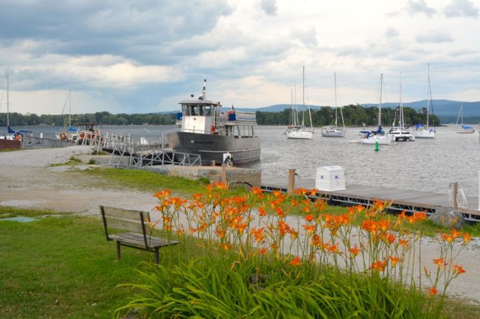
Always exploring, we detoured to Burton Island. This State Park is located in Northwestern Lake Champlain and is only accessible by boat or the Island Runner passenger ferry service from Kamp Kill Kare Park, a summer camp for boys until 1966.
We boarded the ferry with our bikes and spent the afternoon discovering the island. The unique park offers campsites, lean-tos and 100 boat slips, as well as walking trails and a small bistro selling wine and beer to the many summer vacationers.
We returned to Kill Kare where we watched the storm, which we’d anticipated all day, roll-in across Lake Champlain.

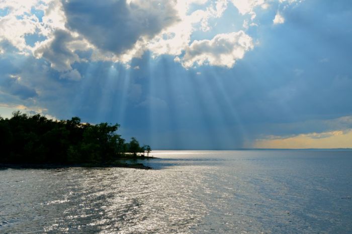
A tempestuous end to our “We LoVermont” mini-getaway.


Quite beautiful G&G, and fun— right down to the dirty looks I probably would have received for not making reservations. Thanks for taking me along. 🙂 –Curt
Curt, it was Gordon way to toughen me up and remind me that it’s good practice for our upcoming trip. Not only might we find ourselves without a reservation, but not speaking the language either. Oh gosh, the places I’ll end up staying at:) – Ginette
Adventure, Ginette… it’s called adventure. 🙂